


The ILVA Italsider archeological industrial complex
the hiatus of Phlegraean thermalism
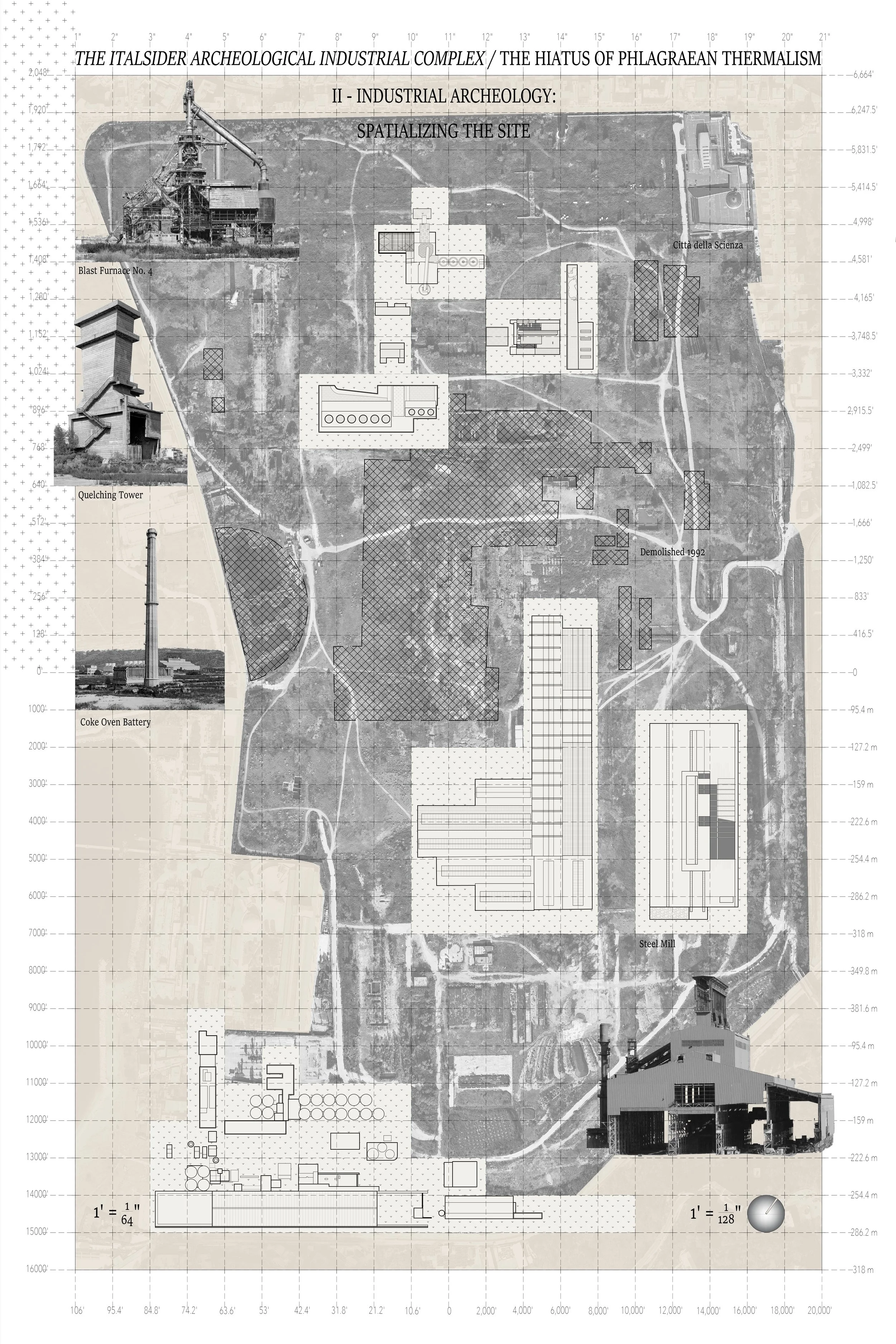
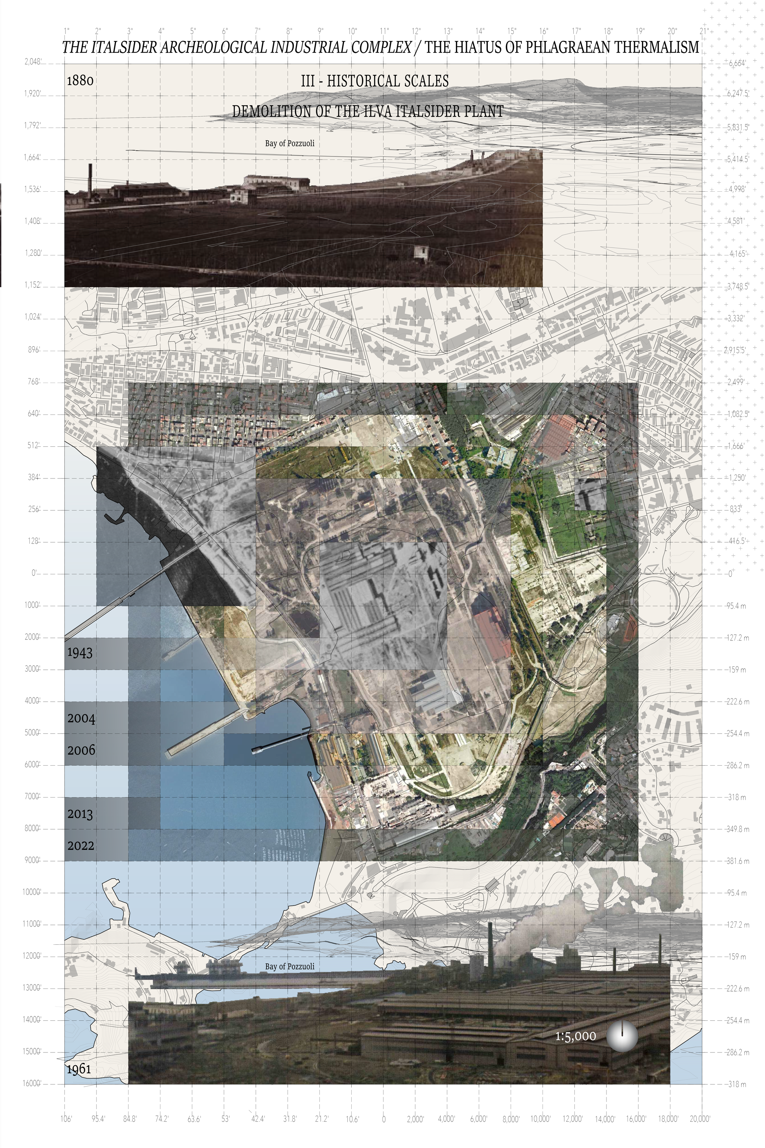
This project conceptualizes the “urban artifact” as a phenomenological apparatus through which a disused coastal industrial site can become a tool to analyze the relationship between history, policy, the body, cities, and resources. Bagnoli, a municipality in the city of Naples, is host to an archeological industrial site that sits between a small river and the Gulf of Naples, above the Bagnoli – Fuorigrotta volcano-tectonic plain. The ILVA plant – later known as the Italsider steel mill- was at one point in the early 20th century, considered to be “the steelwork cathedral” -or maybe we could find a word that more appropriately describes the urbanistic scale of the operation- of the South of Italy. Located on a politically, geologically, and culturally congested site, the plant was built on land that wasn’t a stranger to human intervention. The name Bagnoli has origins in the latin Balneoli -city of baths-. It was predominantly used for agriculture until 1875, around which time there was an initial aspirational plan to re-evaluate the revival of the historic condition of the area as a site for thermal pools and expand the program towards tourist balnearios.
The economic crisis that arose after the cholera epidemic that struck Naples and the Bay of Pozzuoli between 1884 and 1887, however, brought with it a wave of policy implementation, such as the Nitti Law; which G. Dispoto and A. di Gennaro, succinctly summarize as having “paved the way for state intervention in favor of the development of heavy industry, thus giving rise to a contradictory coexistence between the paradisal reconception of Bagnoli and an industrial Bagnoli”. The decision to finally establish the Ilva plant for steel and iron works of Bagnoli, in 1910, didn’t only have cultural and economic repercussions. It is widely considered that little thought was given at the time to the environmental consequences of the factory; and I would go further and seek to complicate the decision by superimposing the geomorphological stratification -both conceptual and physical- of Bagnoli. If the site is analyzed through the different elements that compose it, and start, for instance, with the land -and perhaps the air is a viable character in this category as well- we can start with
Alberico, Petrosino and Lirer’s (2011) almost prose-like account of -let’s call them natural activations- to the site:
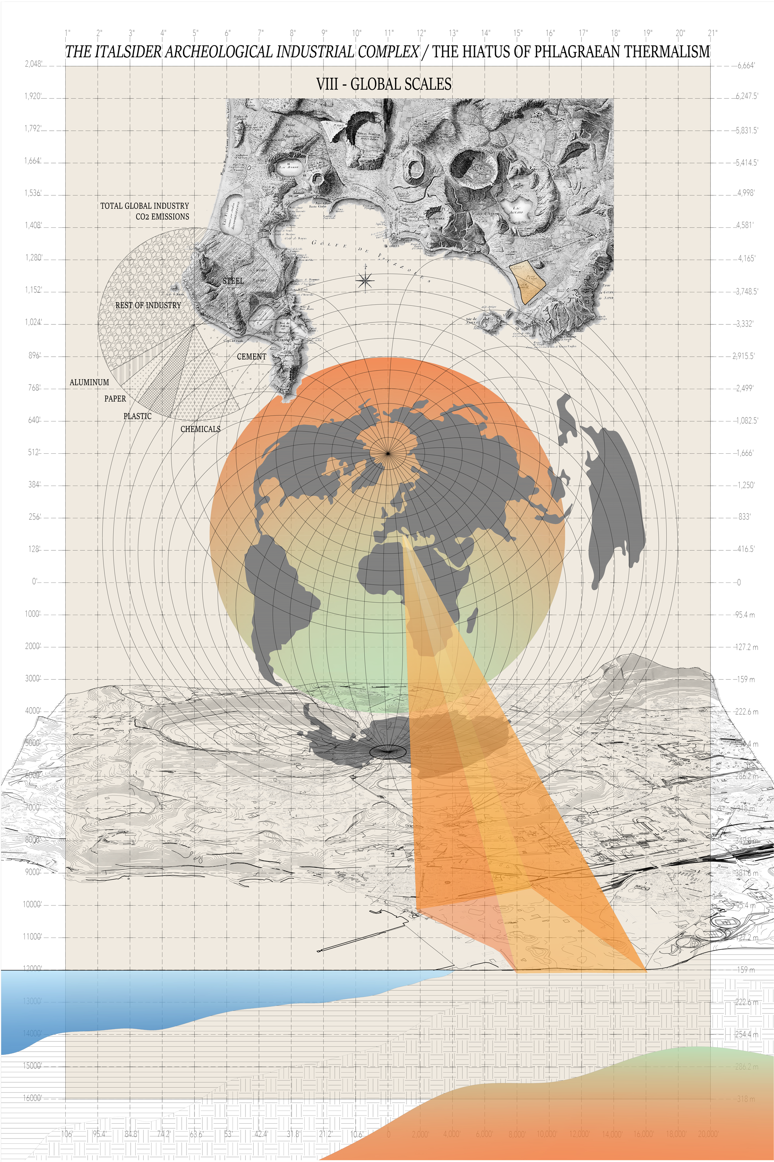
First of all, earthquakes by both the Apennine chain tectonic seismic source and the Campi Flegrei and Somma Vesuvio volcanic sources can be felt in Napoli. Moreover, landslide phenomena can involve both the welded volcanic rock steep slopes of the hills bordering the city and the pyroclastic covers emplaced by past volcanic activity. The Neapolitan Yellow Tuff, a soft welded pyroclastic rock which makes up most of the Napoli underground, in the past was intensively exploited by man and now is crossed by a net of subterraneous galleries whose roofs often collapse. Flood events are very frequent as well, due to the geomorphological onset of the city, which mainly lies on narrow coastal plains bordered by pyroclastic hills, whose slopes quicken the flow of sediment-laden waters toward the sea.
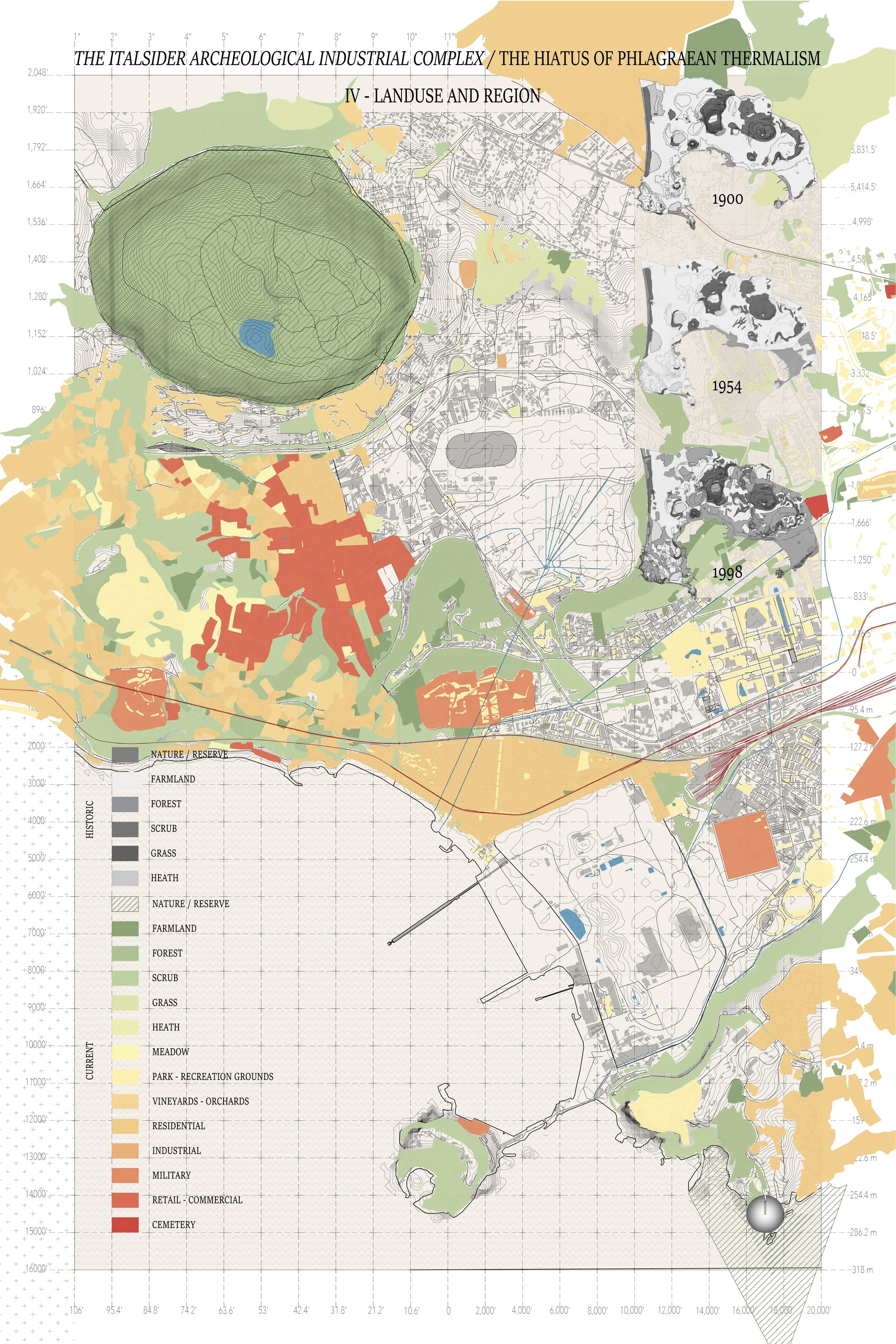
Added to these phenomena; the hazard map of Napoli identifies the industrial site as an H2 risk classification; which means it is within the line of danger for pyroclastic fall products sourcing from Campi Flegrei. Liminal to the site, and the ultimate recipient of industrial and geochemical waste, is the water. The coastline and the bay become the unlikely supporting characters of a site caught in between industrial and volcanic systems, weaving the utopian ideal of Balneoli into a complex landscape. Throughout the following pages the history -past, present, and future- of the Italsider industrial complex is questioned and further complicated.
The drawings above look at the site through increasingly vertical analysis. What I mean by this is that, if the first two drawings look parallelly at the contextual history of the factory, at the bureaucratic events and governmental decisions that lead to its establishment and then at its spatial elements and their own use and change over time, then the last drawing increasingly become an inquiry of how decisions that are made at the earth’s crust start to seep into its other layers, both physically and conceptually.